Drones to the Rescue. Quick Crisis Solutions.
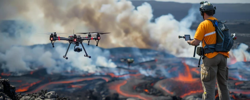
1. Aerial Damage Assessment:
Our drones provide rapid aerial assessments of disaster-affected areas, capturing high-resolution images to evaluate damage and plan relief efforts. This service is crucial for effective disaster response and recovery.
2. Search and Rescue Operations:
We use drones to assist in search and rescue operations, providing aerial views and thermal imaging to locate missing persons and assess hazards. This service enhances the speed and effectiveness of search and rescue efforts.
3. Rapid Deployment of Supplies:
Our drones deliver essential supplies to disaster-affected areas, ensuring that aid reaches those in need quickly and efficiently.
4. Communication Support:
We provide communication support in disaster-affected areas using drones to establish temporary communication networks. This service ensures that communication lines are quickly restored, supporting effective disaster response and coordination.
5. Post-Disaster Mapping and Reconstruction:
Our drones create detailed maps of disaster-affected areas, providing data for reconstruction planning and damage assessment. This service supports effective rebuilding and recovery efforts.